Monday, October 31, 2011

PUNGGOL PROMENADE (30TH OCT 2011)

Punggol Promenade is a 5-kilometre long public waterfront promenade serving as a key pedestrian connector for the future Punggol Waterfront Town. Environmental improvement works include an arrival plaza next to the existing beach, a water lily pond park, fishing platforms leaning over the water edge and bridge crossings over canals. Application of sustainable building materials such as GRC simulated concrete, laterite and oxidised steel throughout the promenade makes for an environmentally friendly development.
The newly opened portion of the $16.7-million Punggol Promenade, located along the eastern bank of Serangoon Reservoir is a result of 2 years of construction; the groundbreaking for the riverfront recreational area took place in 2009.
The estuary of Sungei Serangoon was dammed in 2009 to form the reservoir. The 4.9km promenade has been designated a recreational space for residents in the area. It also links Punggol Point to Punggol East and joins up further south with the park connectors along Serangoon Reservoir and Punggol Reservoir. Only its Riverside Walk portion is accessible currently.Officially opened recently, it is just a short walk from Riviera LRT station. Three food and beverage outlets - a bistro, a seafood restaurant and a fast-food outlet - have also opened in the area. The Riverside Walk features exercise stations, designated cycling and jogging tracks and lookout points that allow visitors to get closer to the water.

The next phase of construction will include a driving range and other facilities. Two other zones, the Nature Walk and Punggol Point Walk, are expected to open later in the year.Nature lovers will also be drawn to the promenade. It is connected by a bridge over Serangoon Reservoir to Lorong Halus Wetland, a biodiversity haven for flora and fauna such as the White-breasted Waterhen and the Striated Heron, also known as the Little Heron. Formerly part of a landfill, it has been converted into an educational site and aims to be a sanctuary for plants, birds and other wildlife.Punggol Promenade Riverside Walk

Thursday, October 27, 2011

Upcoming Punggol Mall to Offer Waterfront Shopping in Singapore (26th Oct 2011)

Looking forward to the upcoming Waterway Point near 2015..in making Punggol waterway an exciting town to live in...

Alfresco dining and waterfront shopping options could be on the cards for Punggol, with the development of the town's newest shopping mall, which will be linked to Punggol MRT station.

The project, called Waterway Point, is the latest in the fast-rising tide of developments in the new town, where a major water feature opened on Sunday.

The new retail project is part of Watertown, a mixed-use project to be jointly developed by Frasers Centrepoint, Far East Organization and Sekisui House.

Earlier this year, the three partners paid $1.02 billion for the 3ha site, which is located at one of the bends of the newly opened Punggol Waterway.

Described as the 'Venice of Punggol', the $225 million waterway development is touted as the centerpiece of the new town, cutting a 4.2km route through Punggol estate.

Frasers Centrepoint told The Straits Times that while the retail project is still in the early stages of planning and development, some of the details have already been firmed up.

Retail will form the biggest component of the mall, taking up 40 percent. Another 30 percent will be for food and beverage outlets, while entertainment businesses and activities will make up 15 percent.

The remaining 15 percent will be dedicated to facilities such as educational institutions and banks, as well as civic and community amenities like libraries.

Tenants will be spread out across six levels - four above-ground and two basement floors.

Another feature of the mall is that it will be the first to be integrated with the Punggol MRT and LRT networks and the nearby bus interchange.

People will also be able to visit the integrated town square and visitors' centre, where they can learn more about the heritage of Punggol through exhibitions and community events.

The mall is scheduled to be completed in 2015. Frasers Centrepoint said more details will be available within the next few months.

"We are confident that Waterway Point will be a key feature in the waterfront town... and will be a charming, iconic retail space that will resonate with the community," said Lim Ee Seng, Frasers Centrepoint's group chief executive.

He added that the group aims to create a unique retail destination that will not only excite the Punggol residents, but also draw visitors from all over the island.

Aside from the shopping mall, the Watertown project will house a residential component, containing more than 900 homes, including suites, Soho (small office, home office) apartments, sky patios and condominium units.

Nicholas Mak, SLP International's head of research, said: "Punggol is a growing town and currently doesn't have a major retail mall within the estate... While the mall's location next to Punggol Waterway does add to the attraction, it is likely to do well regardless of that feature."

Reprinted courtesy of Straits Times Indonesia. To subscribe to Straits Times Indonesia and/or the Jakarta Globe call 021 2553 5055.

Cheryl Lim - Straits Times Indonesia | October 26, 2011

Tuesday, October 25, 2011

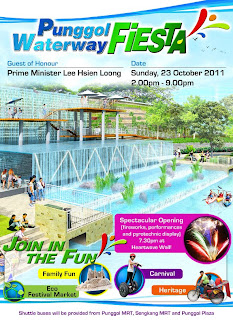
OFFICIAL OPENING OF PUNGGOL WATERWAY (23RD OCT 2011)

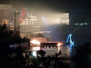
Punggol Fiesta @ the waterway. Official opening by PM Lee Hsin Loong 745pm at the Heartland wave with speculator firework along. Shuttle services were also availible to ferry residents from Sengkang and Punggol Plaza.


Friday, October 14, 2011

Future MRT Network

Speculative Future MRT Line linking every part of S'pore.


It shows Singapore’s existing East-West, North-South, North-East and Circle lines, along with several other MRT lines that fill up gaps in the current MRT network.

Other lines that are mentioned are the Thomson Line (orange), Holland Line (lime green), Choa Chu Kang (lime green), Tampines Line (navy blue), North Shore Line (royal blue) and Seletar Line (aquamarine).

There are also several LRT lines included in the picture, namely the Jurong Region LRT, Tuas LRT and River Valley LRT.

Visible near the top of the picture is a line that stretches into Johor Bahru, Malaysia.

Real or not, this picture has been making its rounds over Facebook, with over 500 users sharing it with their friends. It's also unclear who designed or came up with the map.

But based on maps of other major cities with sprawling train and tube networks, this may be not far off the mark.

In fact, a look at the Land Transport Masterplan revealed that a Tuas extension, North-South Line extension (both to be ready by 2015), Thomson Line (2018) and Eastern Region Line (2020) are in the works.

Yahoo! reader Boeytahan said of the map, "If MRT actually has so many stations, those stations are sharing faciilties and tunnels. If you shop underground, you can travel around Singapore by walking."

Another user, Sin, added, "Of course we still have room for more subway lines. The only worry is flooding after all the underground works. If we are really well connected, then of course the train can be my other mode of transport."

When contacted, a Land Transport Authority spokesperson neither confirmed nor denied the map's accuracy.

Here's their response:

"The planning of our Rapid Transit System (RTS) lines is a complex undertaking, involving careful analysis of urban planning factors such as land use, population and employment quantum. This is first carried out at the macro level as part of the Concept Plan review, where various government planning agencies are involved to map out the long-term blueprint for Singapore's physical development. This is to ensure that land use and transport are well-integrated. A rail master plan is then developed to serve Singapore's long-term transport demand.

Next, planning feasibility studies are done for RTS lines which are identified for implementation in the near to medium term (such as the RTS lines identified in the Land Transport Master Plan). For each of these RTS lines, rigorous analyses such as travel demand, accessibility, land impacts, and engineering considerations are studied. Inputs are also obtained from other government agencies to determine how the proposed line can reap maximum benefits for the community.

Unauthorised maps often give rise to confusion. We advise the public to refer to our website for official and accurate information on MRT lines."

Don't quite understand what they're saying? Seems hazy to us as well.

Anyway, here are the subway networks of London (population 7.8 million) and Tokyo (population 13 million) -- other densely populated cities that rely heavily on trains for public transport.